Hurricane IanNOAA NWS National Hurricane Center
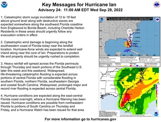
...EXTREMELY DANGEROUS EYEWALL OF IAN MOVING ONSHORE... ...IAN WILL CAUSE CATASTROPHIC STORM SURGE, WINDS, AND FLOODING IN THE FLORIDA PENINSULA SOON... At 1100 AM EDT (1500 UTC), the eye of Hurricane Ian was located about 45 miles west-northwest of Naples, Florida. Ian is moving toward the north-northeast near 9 mph (15 km/h). This general motion with a reduction in forward speed is forecast today, followed by a turn toward the northeast on Thursday. On the forecast track, the center of Ian is expected to move onshore within the hurricane warning area in a few hours, move over central Florida tonight and Thursday morning and emerge over the western Atlantic by late Thursday. Ian is forecast to turn northward on Friday and approach the northeastern Florida, Georgia and South Carolina coasts late Friday. Maximum sustained winds remain near 155 mph (250 km/h) with higher gusts. Ian is a category 4 hurricane on the Saffir-Simpson Hurricane Wind Scale. Ian is forecast to make landfall on the west coast of Florida as a catastrophic hurricane. Weakening is expected after landfall, but Ian could be near hurricane strength when it moves over the Florida East coast tomorrow, and when it approaches the northeastern Florida, Georgia and South Carolina coasts late Friday. Hurricane-force winds extend outward up to 45 miles (75 km) from the center and tropical-storm-force winds extend outward up to 175 miles (280 km). The estimated minimum central pressure is 937 mb (27.67 inches). Visit the National Hurricane Center website at hurricanes.gov for additional forecast information on Ian. The next intermediate advisory will be at 2:00 PM EDT, followed by the next complete advisory at 5:00 PM EDT.
|
|
|
|
From Brevard County Emergency Management9/28/22 11:45 am: There are no evacuations planned for Hurricane Ian at this time.If you feel you are in a high flood zone and wish to evacuate Brevard County has opened three shelters.
The following shelters will be pet-friendly and available for our special needs and general population:- Walter Butler Community Center, 4201 N Cocoa Blvd, Cocoa, FL 32927
- Wickham Park Community Center, 2815 Leisure Way, Melbourne, FL 32935
- Max K. Rodes Community Center, 3410 Flanagan Ave West Melbourne, FL 32904
For updates from the EOC you may sign up by texting BREVARDEOC to 888777. Brevard County solid waste collection has been temporarily suspended through Friday. Any garbage cans or trash receptacles taken to the curb for collection need to be removed to prevent potential debris issues or damages related to Hurricane Ian. |
|
|
|
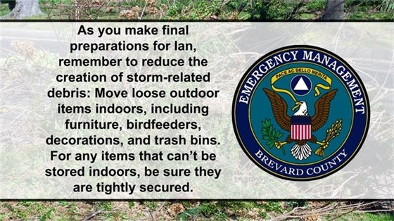
Do your Final Checks!
Please ensure your trash cans, yards signs, ornaments and any other items on your property is secure and put away.
Reduce water usage during the storm! This will reduce the amount on the sewer overflow with the increase amount of rain.
|
|
|
|
Brevard County Fire DepartmentOcean Rescue and beach services will be suspended at 12pm in preparation of the incoming storm and will resume once conditions improve. Swell associated with Ian will lead to dangerous rip currents and surf this week. A HIGH Risk of Rip Currents begins Wednesday. |
|
|
|